Applications
Landfill monitoring
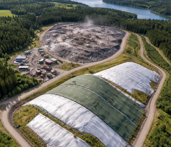
Landfills are one of the largest sources of human-made methane, and their surface emissions are notoriously hard to quantify. Methane escapes unevenly across a cover, concentrated in small hotspots that conventional surveys often miss. TerraTrace measures methane and CO2 flux directly at the soil surface, giving operators defensible, location-specific emission data instead of estimates.
What we measure
Reliable data, smarter decisions.
– Direct surface flux of CH4 and CO2 across cover soils, biocovers and engineered caps
– Methane oxidation performance, the share of methane consumed by the cover before it reaches the atmosphere, using the CH4/CO2 ratio
– Localised emission hotspots, so maintenance and gas-capture can be targeted where it matters
– Change over time, through structured repeat surveys of the same site
Measure What Matters Most
Closed flux chambers are the only method able to measure methane uptake (negative flux) and to prove the oxidation performance of engineered cover and biocover systems. Combined with geotagged data collection and mapping, single measurements become a clear emission picture across a whole site, supporting emission control, reporting obligations and site optimisation.
Oil and gas
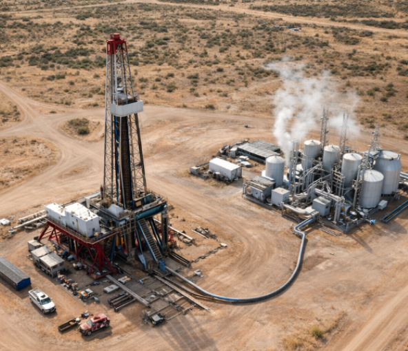
From January 2027, the EU Methane Regulation requires energy-sector operators to move from emission-factor estimates to direct measurement, with formal Monitoring, Reporting and Verification (MRV) and Leak Detection and Repair (LDAR) programmes. TerraTrace provides ground-based, direct measurement of methane flux from the soil above buried infrastructure, with a capability most tools lack: telling you where the methane actually comes from.
What we measure
Reliable data, smarter decisions.
– Direct soil flux quantification of methane along pipeline rights-of-way and accessible corridors
– Source attribution using the CH4/C2H6 (methane to ethane) ratio, distinguishing thermogenic gas (a pipeline leak) from biogenic methane (natural soil background)
– An optional third marker, CO2 flux, for an even more robust origin signature
– Structured, repeatable survey data to support an MRV report
Measure What Matters Most
When methane is detected at the surface, the decisive question for any MRV report is simple: is it your pipeline, or natural background? TerraTrace answers it directly, across the accessible soil sections of a network, suburban and rural corridors, parks and green areas above buried lines, turning a reading into evidence you can defend.
Volcanology
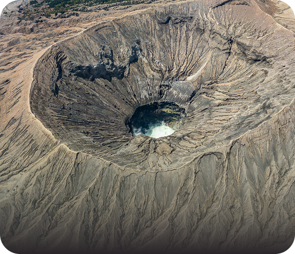
TerraTrace instruments grew out of volcanological and geothermal research, where surface gas fluxes span an enormous range. The systems measure from faint soil respiration up to active volcanic degassing, from 0.11 to 880,000 g per square metre per day, making them suited to diffuse degassing studies, geothermal site characterisation and natural emission baselines.
What we measure
Reliable data, smarter decisions.
– High-resolution CO2, CH4, H2O and trace-gas flux across degassing areas
– Diffuse soil degassing mapping for craters, fumarolic fields and geothermal systems
– Long-term monitoring and repeat surveys to track how degassing patterns change
Measure What Matters Most
The very wide dynamic range and whole-system design mean a single instrument family covers everything from low-level soil studies to high-output volcanic and geothermal sites. The platform is built on decades of field instrumentation experience and is already in use in research deployments.
Environmental Protection
Beyond energy and waste, accurate soil gas measurement underpins a wide range of environmental and regulatory work. TerraTrace supports remediation monitoring, contaminated-site assessment, ecosystem and soil research, and corporate emissions reporting, where direct measurement is increasingly expected over default factors.
What we measure
Reliable data, smarter decisions.
– Soil flux of CO2, CH4, N2O, H2O and VOCs for environmental assessment and research
– Remediation monitoring, tracking gas emissions before, during and after intervention
– Carbon capture and storage verification, with measurement as an assurance and refinement indicator
– Direct (Tier 3) measurement data for sustainability and corporate reporting, for example under CSRD, replacing IPCC default factors
Measure What Matters Most
Regulators, researchers and reporting teams increasingly need measured evidence rather than estimates. TerraTrace turns field measurement into structured, mappable, defensible data that stands up to scrutiny.